After a good sleep, recharged and ready to continue the journey we checked out from the hotel around 7.30am with a plan to visit a famous temple before we leave My Tho.
We were continuously blessed with good weather the temple is not too far from the place we were staying and breakfast can come later.
A cable bridge so near yet so far to cross, we will be come back for you.
After less than 3km we could see sign of Vinh Trang Temple with a huge standing Buddha statue and an ornamented gateway.
Vĩnh Tràng Chùa is a Buddhist temple near Mỹ Tho in the Mekong Delta region of southern Vietnam. It is one of the best-known temples in the region. Location at GPS : 10.362038, 106.373553
Statue of the Buddha Amitābha of Vĩnh Tràng Chùa.
Budai (Bố Đại) statue, God of Happiness
Bicycles are prohibited to enter the compound.
Coconut ice cream seller on two wheels.
Within a stone throw away we patronised a eatery shop for an indulgence of more soup noodle.
I enjoyed this clear noodle with slices of lean meat.
Of course my kaw kaw (concentrated) Vietnamese coffee without sugar nor milk. The ice cubes will slowly melt and dilute the concentration to suit oneself.
A toilet visit at another temple nearby.
The bridge crossing Bảo Định canal which is connected to Mekong River and in the vicinity of the Mekong Delta.
The busy part of My Tho as we were leaving the town.
We stopped by this scenic river side along
Hoàng Sa to take some photos.
Some of the boats seen at
Hoàng Sa (kind of a boulevard) with a cable bridge at the back ground.
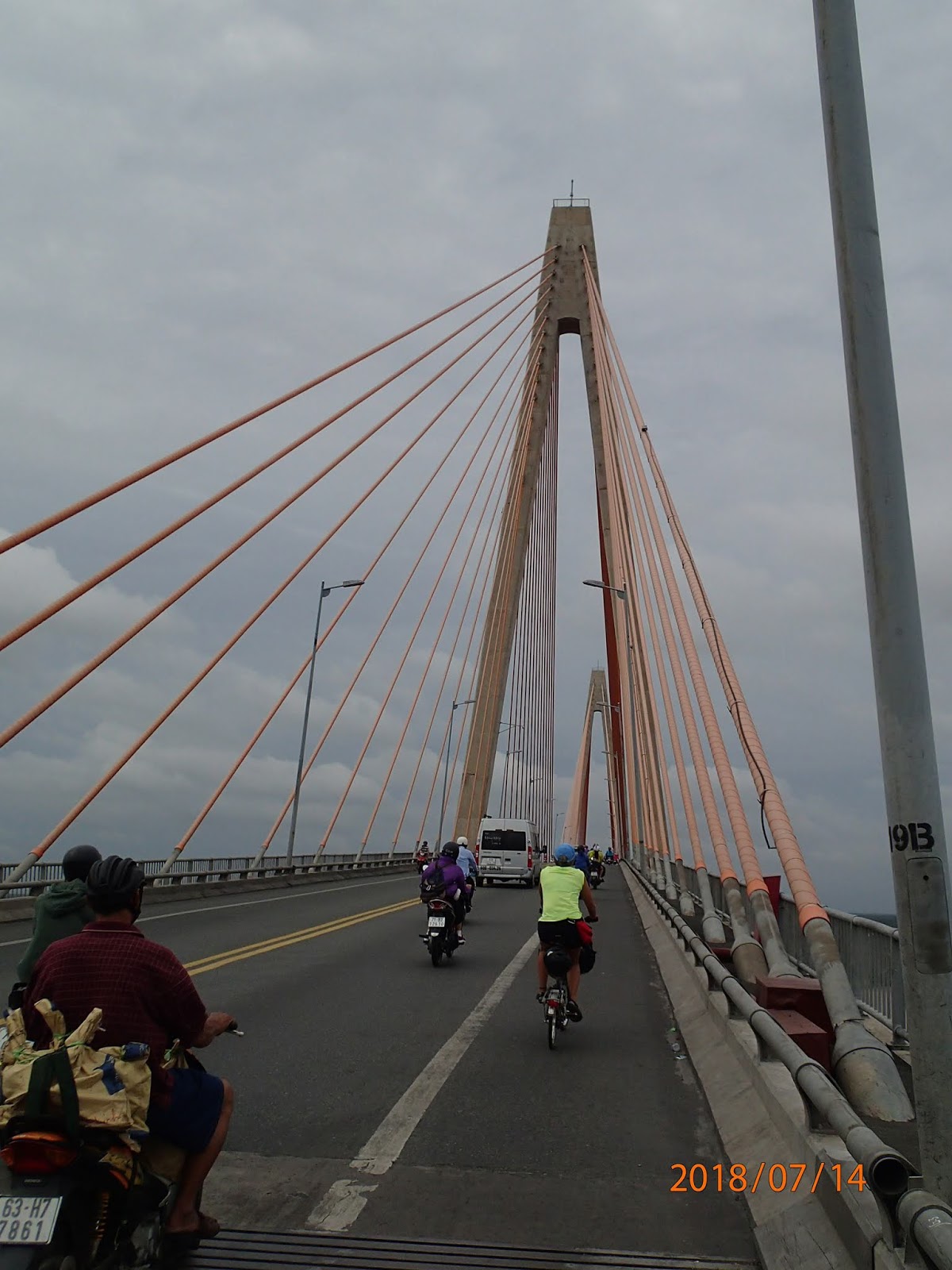
Rạch Miễu Bridge (Vietnamese: Cầu Rạch Miễu) is a cable-stayed bridge in the Mekong Delta. The bridge connects Tiền Giang Province (Mỹ Tho) with Bến Tre Province, over the Mekong.
As viewed from the bridge before we roll down towards Ben Tre.
One of the many stalls selling dried stuff like coconut candies.
Joe lost and found a new shade from this man.
Ham Luong Bridge over Ham Luong River - Ben Tre GPS : 10.235555, 106.334917
Here comes the rain but our ride continued as it was not that threatening.
Though it was wet but a cooling day to cycle.
Fenn was gamed for a durian and I was equally anxious on the taste of a Vietnamese durian. I like the taste but nothing like our Malaysian durian.
The eating stall that we stopped by, had a durian, a good lunch and rest. Again the many hammocks in the many eatery stalls which allow the customers to lay and rest. GPS : 10.153754, 106.330368
Another venture into the local delicacies and also the famous coffee.
We took a detour to a road called Công Lý filled with coconut production activities and this route is running along a river. The GPS location is 10.124751, 106.323491.
The coconut husk fibre or also known as coir extracted from the coconut husk and used to made floormated, mattresses, brushes and sometimes used for burning.
Local ladies dehusking coconut under a shade next to the river and many barges carrying fresh coconuts busy ferrying in the river.
The road seems very interior and I started to get worry whether we were on course.
We were lucky that we could proceed pedalling and continue our ride without any U-turn.
River activities are the main characteristic of Mekong Delta whether it is on the main river or the many canals.
Another narrow bridge crossing at our KM44 and was glad that the journey continued seeing interesting rural scene of Mekong.
A sign of civilisation with more live and activities ahead of us.
A small commercial community with a few shops and a flooded road which we had to go through.
Most of us dismounted and pushed through the obstacle.
Another narrow bridge over a stream at our KM 52.
One of the two motobikes ferrying a pig in a cage trailer heading our opposite direction.
The route that we were cycling actually runs in the vicinity of a river known as Cổ Chiên River which flow through for 82 kilometres through Bến Tre Province, Trà Vinh Province and Vĩnh Long.
Suddenly the road was muddy road and stretches a long way, cycling and balancing of one's bike has to be be very skillful. Sometime the surfaces could slippery with slimy laterite mud.
Sometime a long moment of silent with no live along the track.
Somewhere at our KM 58 we came across a hut with people enjoying their drinks, they waved to us and were friendly.
What a relief when we have reach a ferry terminal the road remain of gravel without any distinguish jetty structure.
The ferry awaiting for its passengers to board.
I found out later the name of this crossing is known as Vam Don Ferry Terminal.
Payment for the ferry ride was made only after the crossing at a small toll house.
We could feel the closeness to a town with the traffic volume increasing and more buildings encountered.
5,000 dong for a quick bike wash as we were approaching Tra Vinh town. All satisfied with our clean bicycles and no more mud sticking on the bikes.
We found out that the hotel marked on our GPS devices was fully booked, we had to search for alternative. Fortunately the staff gave us a recommendation. We checked into another hotel near by for the night.
We went through 70km from My Tho via Ben Tre to Tra Vinh and one of the toughest road conditions ever done during the tour.
The time was 7.00am we were set to leave Ho Chi Minh city before the traffic gets heavier. We kept some of our stuffs here in the hotel and will be back to this hotel after a couple of days exploring Mekong Delta.
Slowly we rolled out south bound towards our destination. Our target was to reach My Tho by end of the day.
The morning crowd comprising of people buying food in the morning and motorbikes piling up to either going to works or to the market.
Marketing at the roadside is commonly seen in Vietnam despite the heavy traffic flow passing by. The people don't seems to be bothered by the traffic. Honking from the motor bikes and vehicles are just like music to them. A music of caution to the traffic users.
After about 13km of cycling we decided to stop for our breakfast at a place that seems to be popular among the locals.
Most of us were attracted by the BBQ meat rice, the ladies serving the food while a man at the side barbecuing the meat.
My choice of the food for the morning.
After the breakfast we decided to take the secondary roads which are of lesser traffic and quieter.
A group 6 yellow shirt cyclists on small wheels making the the local smiling as we tried to communicate with them.
A typical small town scene with people crowding at market areas doing their daily chores and as usual motor bikes are every where.
At our KM26 we took a stop for fresh coconut water with each a plastic kola and a glass of ice cube to quench our thirst. I simply love the coconut water it's so soothing and tasty. Located somewhere along Nguen Huu Tri road with a GPS location at 10.657465, 106.506222
Hammock rest place is a common thing in this part of the world. It is indeed an excellent place relax and rest before one continues its journey.
Buddhist temple Chua Phouc Bao with a huge Buddha statue standing right in front of the temple GPS : 10.634737, 106.466623 We were here at our KM32.
The was an event going on inside the temple some of the youngsters were attracted by our bicycles and one of them even jumped into my Brompton for a spin around the temple. Fortunately he did not ride it away.
A short while at the rear of the temple before we went on with our journey.
This shade is formed by plants that looks like a building.
Later we saw a big monument with a Vietnamese flag flying from the main road at KM42 and later we found out that it was a Military cemetery at Long An GPS : 10.562386, 106.419037
In the inside of the military memorial park where the cemetery is situated.
Next to the cemetery there is a monument park GPS : 10.559866, 106.418190
We noted that there are many people selling these lottery tickets irrespective whether in the towns or in the rural areas.
All six of us bought our Vietnamese conical hats (sometime referred as farmer's hat) at this shop for 32,000 Dong.
Our first pose with the conical hats in front of a restaurant next to the shop where we bought the hats.
We continued the ride all wearing the hats, all looking like local farmers. The route was pretty quiet and nice to cycle.
Enjoying the view of Bao Dinh Canal while we were waiting of our lunch to be served. Location at Ngugen Cuu Van Road GPS : 10.524554, 106.403818
Playing with a toddler while waiting for our food to come.
By now we have passed the town Tan An and into the rural areas towards to the direction of My Tho with an anticipation of the elements of Mekong Delta to emerge.
The weather was superb we do not to have to fear the chance of raining and thunderstorm as forecast.
There is a lot of coconut productions seen which later I understand that it is one of the main national economy of Vietnam and the country is the world's eighth largest producer of coconuts,
Based on the GPS route we were supposed to cross this bridge but it was closed for repair and we were directed to use another route. And so we have ventured the new route.
We were not sure of the direction we were heading and crossing a narrow bridge that led us to new horizon.
But nevertheless the scene in the area was awesome and the route was a narrow concrete pavement.
Which also led us to vegetation of this farm.
Still on the narrow track as we inched our way out of the farm.
Finally we reached our destination with a distance of 75km to a town called My Tho. We were hungry and could not wait until dinner time.
The noodle soup (pho) was interesting and different from what I have seen earlier in other places. It was indeed a good find and the noodle was delicious.
After knocking a few hotel doors we ended up with Khách Sạn Tấn Lộc 2, Phường 1, Thành phố Mỹ Tho GPS : 10.352915, 106.362538
The route we took on Day 4 Ho Chi Minh to My Tho for a distance of 75km.